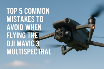
Flying the DJI Mavic 3 Multispectral (Mavic 3M) can unlock an entirely new level of precision agriculture, environmental monitoring, and data-driven decision making. However, many new pilots run into issues that limit the quality of their data or even compromise flight safety. Whether you’re using the Mavic 3M for crop health monitoring, NDVI mapping, or forestry surveys, avoiding these mistakes will ensure smoother operations and more reliable results.
1. Skipping Proper Camera Calibration
One of the most common errors is launching your drone without correctly calibrating the multispectral camera. Calibration ensures that your imagery is accurate and consistent, especially under varying light conditions. Without it, your NDVI maps and data outputs may be unreliable, undermining the value of your surveys.
Tip: Always calibrate the camera before each flight session, ideally in lighting conditions similar to your mission.
2. Using Incorrect Flight Settings
Many pilots overlook flight parameters like altitude, overlap percentage, and flight speed. Incorrect settings can lead to incomplete coverage, poor image stitching, or low-resolution maps.
Tip: For agriculture and mapping missions, maintain 70–80% image overlap and adjust altitude depending on the level of detail required.
3. Ignoring Weather and Lighting Conditions
Flying in harsh sunlight, high winds, or changing weather conditions can affect data quality and drone safety. Shadows, glare, or unstable flights may distort multispectral imagery and create processing errors.
Tip: Choose consistent lighting (early morning or late afternoon works best) and avoid flights in high wind conditions for smooth, accurate captures.
4. Not Following Battery and Storage Best Practices
The DJI Mavic 3M’s intelligent flight batteries provide ample flight time, but failing to monitor them can result in premature landings or incomplete missions. Similarly, insufficient storage on SD cards can cut missions short.
Tip: Always start with fully charged batteries, carry spares, and ensure your SD card has enough space for high-resolution multispectral data.
5. Overlooking Data Processing Workflows
Capturing aerial data is only half the process—many pilots struggle with turning imagery into actionable insights. Mismanaging NDVI map creation or skipping post-processing steps in DJI Terra or similar software can waste valuable data.
Tip: Develop a consistent data pipeline from mission planning to DJI Terra processing, ensuring your NDVI maps and analysis are accurate and usable.
Final Thoughts
Flying the DJI Mavic 3 Multispectral isn’t just about collecting aerial data—it’s about doing it correctly, consistently, and safely. By avoiding these five mistakes, you’ll improve both the quality of your workflows and the reliability of your results, whether for precision agriculture, forestry, or land management.
#DJIMavic3Multispectral #DroneFlyingTips #DroneFlightSafety #MultispectralDrone #PrecisionAgriculture #SmartFarming #NDVI #DroneBestPractices #SpeedyDrone


