
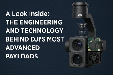
DJI has built its reputation on pushing the boundaries of aerial technology, and nowhere is this more evident than in its enterprise payloads. From LiDAR scanners to multispectral cameras, these payloads are more than just accessories—they’re marvels of engineering. Behind their sleek designs lies a combination of advanced hardware and intelligent software that work together to deliver unmatched performance for surveying, inspection, construction, and public safety missions.
Precision Starts with the Gimbal
At the heart of DJI’s payloads is the 3-axis stabilized gimbal. Designed to minimize vibrations and correct for motion, it ensures that sensors—whether optical, thermal, or LiDAR—capture sharp, stable, and distortion-free data. The gimbal also provides precise pointing accuracy, a necessity for tasks like zoom inspections of powerlines or thermal monitoring of critical infrastructure.
Advanced Sensor Integration
DJI’s payload lineup integrates cutting-edge sensors tailored to different industries:
-
RGB Cameras: Large-format CMOS sensors deliver high-resolution mapping and inspection imagery.
-
Thermal Imagers: Multi-spectral and radiometric thermal sensors detect heat signatures for search and rescue or utility monitoring.
-
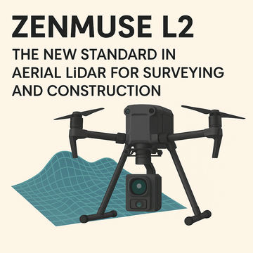
LiDAR Systems: Frame-based LiDAR units, like the Zenmuse L2, provide dense, accurate point clouds even in complex terrain.
-
Multispectral Sensors: Used in agriculture, these sensors capture narrow spectral bands to assess crop health and soil conditions.
By combining these technologies into compact, drone-mounted payloads, DJI reduces the need for bulky, ground-based equipment and makes high-end data collection more accessible.
Seamless Communication with DJI SkyPort
Hardware is only part of the equation. DJI’s SkyPort communication protocol ensures seamless integration between drones and payloads. This standardized interface allows for:
-
Fast Payload Swaps: Quickly change sensors without complicated rewiring.
-
Power Supply Integration: Direct power from the aircraft to the payload, ensuring efficiency.
-
High-Speed Data Transfer: Real-time communication between sensors and flight controllers for instant insights.
This level of integration makes DJI payloads highly versatile across platforms like the Matrice 300 RTK and Matrice 4 Series.
Intelligent Software Ecosystem
Data is only as useful as the tools that interpret it. DJI pairs its payloads with powerful software like DJI Pilot 2 and DJI Terra. These tools provide real-time monitoring, automated mission planning, and advanced data processing, allowing professionals to go from flight to actionable insights in record time.
Why This Matters for Professionals
For surveyors, inspectors, and emergency responders, the combination of gimbal stabilization, advanced sensors, SkyPort integration, and intelligent software translates into:
-
Higher Accuracy: Less distortion, cleaner data, and survey-grade precision.
-
Faster Workflows: Quick payload swaps and real-time data delivery.
-
Lower Costs: Fewer re-flights and reduced reliance on traditional surveying equipment.
-
Expanded Capabilities: One drone platform can serve multiple industries simply by changing payloads.
Final Thoughts
DJI’s most advanced payloads embody the fusion of hardware and software innovation. From precise gimbal engineering to seamless SkyPort integration and intelligent software support, these payloads are designed to perform under real-world conditions while simplifying complex operations.
For professionals who depend on accuracy, efficiency, and reliability, DJI’s engineering makes their payloads not just tools—but indispensable assets in the field.
#DJIEnterprise #EnterprisePayloads #DJIPayloads #DroneTechnology #LiDAR #ThermalImaging #AerialMapping #UAS #DroneSurveying #DJISkyPort