
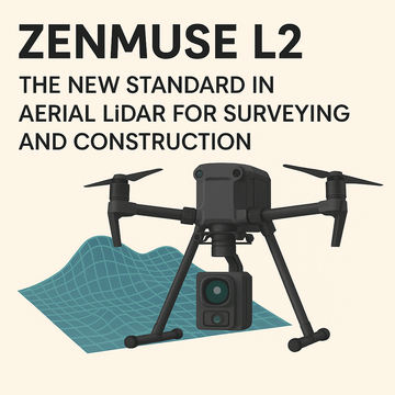
In the world of surveying and construction, precision is everything. Whether it’s mapping a large infrastructure project, monitoring construction progress, or planning land development, professionals rely on accurate, reliable, and efficient data collection tools. DJI’s Zenmuse L2 sets a new benchmark in aerial LiDAR technology, delivering the kind of accuracy and versatility that can transform workflows and significantly reduce costs.
Why the Zenmuse L2 Matters
The Zenmuse L2 is more than just an upgrade—it’s a game-changer for geospatial professionals. Combining a high-accuracy Inertial Measurement Unit (IMU), advanced frame LiDAR system, and a powerful 4/3 CMOS RGB mapping camera, the L2 empowers surveyors and construction managers to capture richer, more precise data in less time.
Instead of juggling multiple payloads or relying on external sensors, the L2 integrates everything into a streamlined, reliable package that works seamlessly with DJI’s enterprise drone platforms.
Key Features
1. High-Accuracy IMU System
The built-in IMU ensures stable, precise measurements by compensating for motion and vibration during flight. This leads to improved georeferencing accuracy, making it ideal for projects where every centimeter counts—such as boundary surveys or high-stakes infrastructure builds.
2. Frame LiDAR Technology
Unlike traditional point-cloud capture, the Zenmuse L2’s frame LiDAR offers denser and more consistent point data. This translates into highly detailed 3D models of terrain, vegetation, and structures, even in challenging environments with vegetation cover or uneven terrain.
3. 4/3 CMOS RGB Mapping Camera
The integrated camera combines with the LiDAR system to generate true-color point clouds and high-resolution imagery. With its large sensor size, it excels in capturing sharp, vibrant images that enhance visualization and analysis. This dual capability means fewer site visits and more comprehensive datasets in a single flight.
Benefits for Surveying and Construction
-
Time Savings: Reduce fieldwork hours with faster, more complete aerial scans.
-
Cost Efficiency: Cut down on repeat flights, manpower, and equipment needs.
-
Precision: Achieve survey-grade accuracy for planning, inspections, and compliance.
-
Versatility: Applicable across industries—urban planning, mining, utilities, and construction.
-
Better Decision-Making: With clearer data, managers and engineers can make faster, more confident calls.
Real-World Applications
-
Surveying: Generate highly accurate digital elevation models (DEMs) and 3D terrain maps.
-
Construction: Monitor site progress, measure volumes, and ensure designs are executed precisely.
-
Infrastructure: Inspect roads, bridges, and utility lines with precision mapping and modeling.
-
Environmental Management: Assess vegetation cover and land-use changes with true-color point clouds.
Final Thoughts
The Zenmuse L2 represents the next leap forward in aerial surveying technology. For surveyors and construction managers, it’s more than just an advanced payload—it’s an investment in efficiency, accuracy, and profitability. By reducing time in the field, improving data quality, and expanding applications, the L2 cements itself as the new standard in aerial LiDAR solutions.
If your projects demand precision and efficiency, upgrading to the Zenmuse L2 is not just an option—it’s a necessity.
#DJI #ZenmuseL2 #LiDAR #AerialSurveying #ConstructionTech #Surveying #Mapping #DroneTechnology #Geospatial #DataAccuracy #DJIEnterprise #DroneSurvey #ConstructionManagement