

From Data to Decisions: A Step-by-Step Guide to Processing Mavic 3M Imagery with DJI Terra
Main Content:
Buying a DJI Mavic 3 Multispectral (Mavic 3M) is just the first step in modern precision agriculture. The real value comes from what you do with the data once the drone lands. That’s where DJI Terra software comes in. This powerful platform transforms raw flight imagery into actionable insights, helping farmers make smarter, data-driven decisions.
Here’s a step-by-step workflow for drone data processing and multispectral image analysis using DJI Terra.
Step 1: Import Flight Data into DJI Terra
After completing your flight with the Mavic 3M, export the image files and metadata (including RTK data if enabled). Open DJI Terra and create a new project. Import the collected images directly into the software.
Pro Tip: Organize your data by date and field name for easy access when comparing results over time.
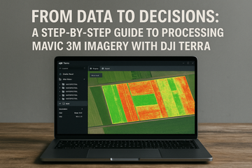
Step 2: Set Project Parameters
In DJI Terra, select 2D Multispectral Reconstruction as your mapping mode. This ensures the software uses the Mavic 3M’s multispectral bands (Green, Red, Red Edge, and NIR) to generate a highly accurate map.
Choose your desired ground sample distance (GSD) and coordinate system. For agronomists, centimeter-level RTK accuracy ensures the highest mapping precision.
Step 3: Run Multispectral Image Processing
Click “Start Reconstruction” to process your dataset. DJI Terra stitches the images together into an orthomosaic, then aligns spectral data across bands.
The result is a seamless, geo-referenced map ready for agricultural analysis.
Step 4: Generate Vegetation Indices (NDVI, NDRE, and More)
With the processed dataset, DJI Terra enables calculation of vegetation indices such as:
-
NDVI (Normalized Difference Vegetation Index): Indicates crop vigor by comparing red and NIR reflectance.
-
NDRE (Normalized Difference Red Edge): More sensitive to chlorophyll changes, making it ideal for detecting early plant stress.
-
Chlorophyll Content Maps: Useful for nutrient management and spotting deficiencies before they’re visible.
These indices highlight areas of your field that need attention—whether it’s irrigation, fertilization, or pest control.
Step 5: Create Prescription Maps for Precision Application
DJI Terra allows you to export prescription maps for variable-rate application. These maps can be uploaded into compatible farm machinery or decision-support platforms. This ensures resources like fertilizer and pesticides are applied only where needed, saving costs and improving sustainability.
Step 6: Share, Compare, and Track Over Time
Processed maps can be exported in formats compatible with farm management systems (Shapefile, GeoTIFF, etc.). Comparing maps across growth stages provides insight into long-term crop performance and field management effectiveness.
Why This Workflow Matters
Without a structured data processing pipeline, drone imagery remains just a collection of photos. With DJI Terra, the Mavic 3M’s imagery becomes actionable intelligence—helping farmers detect problems earlier, apply inputs more efficiently, and maximize yield potential.
#SpeedyDrone #DJI #DJITerra #Mavic3M #DroneDataProcessing #NDVIMaps #MultispectralWorkflow