
The M400 isn't just an evolution; it's a revolution in operational capability. In the rapidly advancing world of industrial drones, raw specifications only tell part of the story. The true measure of a flagship drone lies in its real-world impact—how it empowers professionals to achieve more, work safer, and solve complex challenges. The M400 has proven itself as a versatile powerhouse, redefining what’s possible in five key industries.
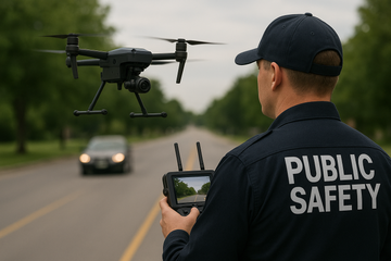
1. Public Safety: A Lifeline in the Sky
For search and rescue teams, every minute counts. The M400’s game-changing combination of long endurance (up to 59 minutes) and multi-payload capability is a literal lifeline. During a large-scale search operation, a single drone can carry a Zenmuse H30T with both a powerful thermal and visual camera. This allows operators to quickly scan vast, remote areas for heat signatures, even at night or through dense foliage. The drone's ability to carry additional payloads like a spotlight or speaker enables direct communication with a subject on the ground, guiding them to safety or providing instructions while ground teams close in. This level of sustained, multi-faceted situational awareness dramatically reduces search times and risk for responders.
2. Power Line Inspections: Safer, Smarter, and More Efficient
Inspecting high-voltage power lines is a high-risk, high-stakes task. The M400 transforms this workflow with its advanced suite of intelligent features. The drone’s rotating LiDAR and mmWave radar provide an unparalleled level of obstacle sensing, allowing it to autonomously navigate complex corridors and detect thin wires, even in challenging weather or at night. The true innovation, however, is its AR (Augmented Reality) projection. Imagine a pilot seeing the location of the power lines and the flight path overlaid directly on their remote controller screen, making high-voltage checks safer and more efficient. Paired with a Zenmuse L2 LiDAR, the M400 can conduct automated corridor mapping, generating precise 3D models to identify vegetation encroachment or line sag with minimal human intervention.
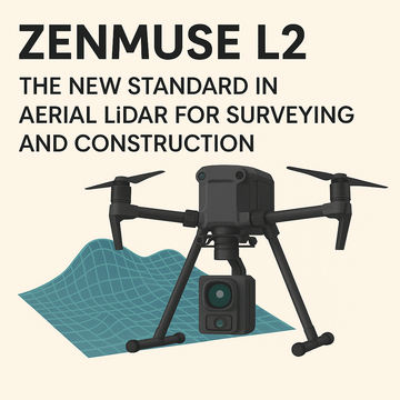
3. Large-Scale Mapping and Surveying: Precision on a Grand Scale
For surveyors and GIS professionals, the M400's extended flight time and robust payload capacity mean a single mission can cover a significantly larger area. When equipped with a high-resolution camera like the Zenmuse P1 or a LiDAR sensor like the Zenmuse L2, the M400 can collect high-accuracy data for large-scale photogrammetry and LiDAR surveys. The drone’s real-time terrain follow feature ensures a consistent ground sampling distance (GSD), which is critical for creating high-precision maps and 3D models. This efficiency translates to fewer flights, faster data acquisition, and lower project costs.
4. Architecture, Engineering, and Construction (AEC): Digital Twins and Project Management
The AEC industry is increasingly reliant on digital tools to improve efficiency and reduce errors. The M400 is at the forefront of this transformation. Its ability to capture high-fidelity imagery and point cloud data allows for the creation of detailed "digital twins" of construction sites and existing infrastructure. Project managers can use the M400 to conduct regular site monitoring, track progress, and perform as-built analysis. Features like AR projection of flight waypoints and real-time live annotations directly on the remote controller display streamline communication and coordination between teams, keeping complex projects on schedule and on budget.
5. Maritime Operations: Extending the Horizon of Possibility
Operating a drone from a ship presents unique challenges, from the movement of the vessel to the harsh maritime environment. The M400 addresses these head-on with its specialized features. It is engineered for take-off from stationary vessels and, with a recent firmware update, can even autonomously land on a moving ship's deck. This capability is a game-changer for a variety of maritime applications, including search and rescue at sea, coastal surveillance, and offshore wind turbine inspections. Its IP55 rating ensures reliable performance in rain, and its extended range transmission systems enable long-distance patrols, making it an invaluable tool for enhancing safety and security on the open water.
#M400 #IndustrialDrone #EnterpriseDrone #PublicSafety #SearchAndRescue #PowerlineInspection #DroneMapping #AEC #MaritimeOperations #DroneTechnology #UAV #DJI #BeyondTheSpecs