
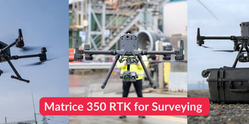
In industries like construction, urban planning, mining, and land management, accuracy is everything. Traditional surveying methods are time-intensive and costly, but enterprise drones now deliver results that rival ground-based tools—at a fraction of the time. The DJI M350 RTK stands out as one of the most capable aerial surveying platforms, combining centimeter-level precision with advanced mission planning features and seamless integration with DJI Terra software.
Why RTK Matters for Surveying
At the heart of the M350 RTK is Real-Time Kinematic (RTK) technology. Unlike standard GPS positioning, RTK uses corrections from a base station or network service to deliver centimeter-level accuracy.
Key Benefits for Surveying:
-
High Precision: Achieve sub-5 cm accuracy in mapping and modeling projects.
-
Fewer Ground Control Points (GCPs): Reduce reliance on time-consuming ground setups.
-
Faster Data Collection: Cover large areas quickly without sacrificing quality.
For surveyors, RTK means faster workflows and reliable deliverables trusted by clients and regulators alike.
Intelligent Mission Planning for Accurate Results
The M350 RTK comes equipped with intelligent flight modes that simplify surveying missions while ensuring consistent data capture:
-
Waypoint Missions: Predefine flight paths and camera angles for repeatable, standardized surveys.
-
Mapping Missions: Automate grid or oblique flight paths for 2D orthomosaics or 3D modeling.
-
Terrain Follow: Maintain consistent altitude over uneven ground, ensuring uniform resolution and accuracy.
These features minimize human error and ensure data sets are consistent—an essential requirement for professional surveys.
DJI Terra: Turning Data Into Deliverables
Collecting data is only half the job. The DJI Terra software suite transforms aerial imagery into actionable outputs:
-
2D Orthomosaics: High-resolution, geo-referenced maps for construction, agriculture, and land management.
-
3D Models & Point Clouds: Detailed, survey-grade digital twins of terrain and infrastructure.
-
LiDAR & Photogrammetry Integration: Seamlessly process data from payloads like the Zenmuse L1 (LiDAR) and Zenmuse P1 (photogrammetry) for industry-specific workflows.
Together, the M350 RTK and DJI Terra provide a complete surveying ecosystem, from flight planning to final deliverables.
Real-World Applications
The M350 RTK is already proving invaluable across industries:
-
Construction: Generate progress maps and as-built documentation with centimeter-level accuracy.
-
Mining & Quarries: Conduct volumetric measurements of stockpiles without halting operations.
-
Urban Planning: Produce detailed 3D models of cities for infrastructure development.
-
Forestry & Agriculture: Map terrain, monitor crop health, and plan sustainable land use.
Each use case benefits from faster turnaround, reduced costs, and safer operations compared to traditional surveying methods.
Final Thoughts: Raising the Bar for Aerial Surveying
The DJI M350 RTK represents the next evolution of high-accuracy drone surveying. Its RTK positioning system, intelligent mission modes, and integration with DJI Terra deliver professional-grade results trusted across industries.
For organizations seeking precision, efficiency, and reliability, the M350 RTK is not just a tool—it’s a surveying and mapping solution designed for the future.
#DJIM350RTK #Surveying #Mapping #DJITerra #RTK #DroneSurveying #2DMapping #3DModeling #EnterpriseDrones