
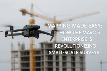
Surveying and mapping have long been resource-intensive tasks, requiring specialized equipment, extensive planning, and significant time investments. With the introduction of the DJI Mavic 3 Enterprise (M3E), small-scale surveyors, engineers, and construction professionals now have a compact, powerful, and cost-effective tool that simplifies workflows without sacrificing accuracy.
Centimeter-Level Accuracy Without Extensive GCPs
At the heart of the Mavic 3 Enterprise is its 4/3 CMOS sensor paired with a mechanical shutter, a combination that ensures distortion-free imaging and supports high-precision aerial mapping. When used with the RTK (Real-Time Kinematic) module, the drone achieves centimeter-level accuracy in positioning, reducing or even eliminating the need for extensive Ground Control Points (GCPs).
This feature is a breakthrough for small teams who often lack the resources or time to set up numerous GCPs in the field. The M3E provides survey-grade results with fewer steps, lowering costs and improving efficiency.
Efficiency in Flight and Coverage
The Mavic 3 Enterprise is designed to maximize efficiency. Thanks to its long flight time and optimized battery system, the drone can cover large areas in a single mission—a task that would otherwise require multiple flights or larger, more expensive platforms.
Surveyors can now conduct detailed mapping of construction sites, farmland, or infrastructure corridors quickly and accurately. With its mechanical shutter speed of 1/2000s, rolling shutter distortions are avoided, ensuring every photo aligns seamlessly during post-processing.
Seamless Workflow with DJI Terra
The real power of the Mavic 3 Enterprise lies not just in data collection, but in how easily that data integrates into professional workflows. With DJI Terra software, users can import images directly from the drone and generate accurate 2D orthomosaics, 3D models, and elevation maps.
This smooth integration reduces turnaround times and ensures that surveyors, engineers, and construction professionals can move from flight to actionable insights faster than ever.
Real-World Impact
-
Surveyors can reduce time in the field and deliver precise maps more efficiently.
-
Engineers can monitor construction progress with up-to-date site models.
-
Agriculture professionals can evaluate land use or plan irrigation with centimeter-level accuracy.
In short, the Mavic 3 Enterprise places professional-grade mapping capabilities into the hands of small teams and individual professionals who previously relied on less efficient solutions.
Conclusion
The DJI Mavic 3 Enterprise is more than just a drone—it’s a revolution in small-scale surveying. By combining a high-quality sensor, mechanical shutter, and RTK capabilities with streamlined DJI Terra workflows, it enables professionals to achieve accuracy, efficiency, and cost savings that were once out of reach.
For surveyors and engineers ready to embrace the future of mapping, the M3E delivers on its promise: Mapping made easy.
#Mavic3Enterprise #DJIEnterprise #DroneSurveying #MappingMadeEasy #RTK #DJITerra #DroneMapping #ConstructionTech #AerialSurveying #SurveyingDrones #SpeedyDrone