
When it comes to enterprise drones, airframe performance is only half the story. The true power of the DJI M350 RTK lies in its ability to carry and integrate advanced payloads tailored to industry-specific needs. From thermal imaging to LiDAR mapping, the M350 RTK transforms into a multi-mission platform, revolutionizing how industrial inspections are carried out across energy, public safety, construction, and surveying.
Versatility at the Core: Payload Compatibility
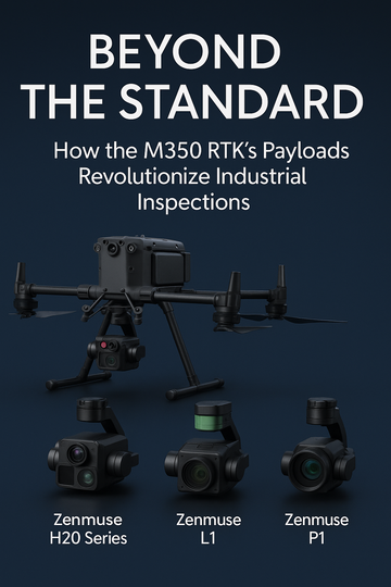
The M350 RTK is designed with multi-payload support, offering flexibility for different missions without requiring separate aircraft. With its robust gimbal system, it supports a wide range of DJI’s most advanced payloads, giving operators unmatched adaptability in the field.
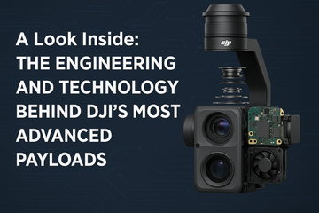
Zenmuse H20 Series: Multi-Sensor for All-Around Inspections
The Zenmuse H20 and H20T payloads represent the gold standard for versatility. These powerful, integrated cameras combine multiple sensors in one device:
-
20 MP zoom camera for detailed inspections at a distance.
-
12 MP wide-angle camera for situational awareness.
-
Laser rangefinder (up to 1,200 m) for precise measurements.
-
Thermal camera (H20T model) for heat detection and temperature monitoring.
Industry Impact:
-
Energy & Utilities: Inspect power lines, substations, and solar farms with thermal overlays to detect faults.
-
Public Safety: Search-and-rescue teams can quickly spot heat signatures of missing persons, even in low visibility.
-
Infrastructure: Bridge and building inspections become safer and more accurate, minimizing the need for scaffolding or manual checks.
Zenmuse L1: LiDAR + Photogrammetry
The Zenmuse L1 brings real-time 3D LiDAR data capture to the M350 RTK. Combined with a high-accuracy IMU and RGB camera, it enables survey-grade mapping with speed and precision.
Industry Impact:
-
Surveying & Mapping: Create high-density 3D point clouds for terrain analysis.
-
Forestry: Conduct biomass assessments and canopy studies with precision.
-
Construction: Generate as-built models for progress tracking and compliance.
By capturing both geometry and colorized detail, the L1 provides deliverables that rival traditional survey methods—at a fraction of the time and cost.
Zenmuse P1: Photogrammetry at Scale
For operators focused on high-resolution mapping, the Zenmuse P1 is purpose-built for photogrammetry. With its 45 MP full-frame sensor and interchangeable lenses, it captures sharp, distortion-free imagery across large areas.
Industry Impact:
-
Surveying: Produce highly accurate orthomosaics and 3D models.
-
Urban Planning: Support infrastructure projects with detailed, geo-referenced maps.
-
Agriculture: Enable precision crop analysis and land-use monitoring.
The P1’s Smart Oblique Capture mode also maximizes efficiency, reducing flight times while still delivering complete, high-quality datasets.
A Platform Built for Every Industry
The power of the M350 RTK is not just its rugged design and long flight times—it’s the ability to adapt to multiple industries with a single airframe:
-
Energy & Utilities: Detect faults before they cause downtime.
-
Public Safety: Save lives with faster, more accurate situational awareness.
-
Surveying & Mapping: Deliver survey-grade results at scale.
-
Construction: Reduce inspection costs while improving data accuracy.
From thermal imaging to LiDAR and photogrammetry, the M350 RTK becomes more than just a drone—it’s an industrial inspection ecosystem.
Final Thoughts: One Drone, Infinite Possibilities
The DJI M350 RTK redefines what enterprises can expect from a drone platform. With payloads like the Zenmuse H20 series, L1, and P1, it becomes a versatile, industry-spanning tool capable of handling the most demanding inspection tasks. For organizations seeking to maximize ROI and operational flexibility, the M350 RTK isn’t just an upgrade—it’s a revolution.
#DJIM350RTK #ZenmuseH20 #ZenmuseL1 #ZenmuseP1 #DJIEnterprise #DroneInspections #LiDAR #ThermalImaging #Photogrammetry